Corfu Trail (2022)
Walking on Greece's greenest island
Rolling olive groves, sandy and stony beaches and countless altars. Walking on the Corfu Trail is an experience. A 150 km long hike from Kavos to Agios Spirdionas where you extensively explore the entire island. Both start and finish can be reached by bus and you start and end the day in a village with cozy terraces and (mini) supermarkets.
Day 1 Cavos - Lefkimmi 14 km
It is a short walk from the hotel to the start of the Corfu Trail. The sidewalks of the small supermarkets and bars in touristy Cavos are scrubbed and washed, a single bus squeezes through the only narrow street and some tourists look at fridge magnets, caps and postcards in one of the countless souvenir shops. It's already quite warm, early in the morning, but because I will be staying in apartments, my backpack is light. Although I do have another half a kilo of Gouda with me. At the edge of the village I look for the sign that refers to a monastery ruin from 1700 in which I expect to recognize the start of the route. I heard from other hikers that the path is moderately marked, but at the otherwise unremarkable intersection there is a clear yellow marking and there are enough yellow painted blazes afterwards that I don't have to constantly hold the GPS in my hand. The route climbs up a semi-paved road past goats and olive trees. The heat makes it a bit tough and I don't have trail legs yet. Once on top of a hill, I have a view of the sea, which is clear blue with bits of aquamarine. A sea like you would see in commercials for tropical resorts. A little later I pass the ruins of the monastery of the Virgin Mary from 1700. The walls are still standing and a deeply worn stone staircase leads to the vanished first floor. Past the monastery the road ends and the path descends into a forest. A real, nice hiking trail, narrow between the trees, occasionally bending over for a tree across the path. Wonderful, this is what I'm here for. Soon I arrive at a concrete road that I follow to the beach of Arkoudilas, where beach beds are still empty. I follow the beach under high cliffs and notice that the tide is slowly getting high. That means I have to stick to the loose sand, but it’s not too bad. Moments later, the cliffs jut out and the beach ends. Ahead I see people walking and a straight line that looks like a road, all I have to do is wade through the sea around a protruding rocky outcrop. The lukewarm water comes to my knees and I continue walking with wet socks. First there is beach, then there are rocks. I am alone except for a couple.
At the end of the beach I climb up to a concrete road, the last meters of which have crumbled and lie a few meters lower on the sand. The route soon leaves the concrete road again and climbs up the flanks of a hill. I struggle up, but rest in the shade for fifteen minutes before continuing again. My body has to get used to the heat noticeably, it's not easy for me. When I descend to the hamlet of Spartarene I plonk down on the first terrace I come across, while a fisherman promotes his wares from a pick-up truck. His loudspeaker voice reverberates against the houses. In the trunk I see styrofoam cooler boxes and a scale. After two colas and some fruit from the garden that the owner proudly presents on a saucer, I continue. I feel energetic again and walking is easier, although that can of course also be because the route descends considerably. In one place I take a wrong turn and only realize it after half a kilometer when I reach the wrong village, but that is my own fault. The route is marked, although the paint streaks are sometimes a bit hidden and you have to keep an eye out. Fortunately I have the route on GPS and getting lost is impossible. At the port of Potami I settle down on a terrace. It is barely 1 km to my apartment, but it is still early. Narrow boats bob on the canal, pulling on their ropes. In the clear water I see fish chasing each other. A dog walks from table to table and when I pour some water into an ashtray, he gulps it right down. This is so relaxing. Usually I steam blindly to the finish, but today I feel languid and enjoy the lazy Greek life. An hour later I cover the last kilometer to Lefkimmi after all.
Day 2 Lefkimmi - Paramonas 30 km
I start early and luckily it's cloudy, so it's not very hot right away. I walk past the imposing church through the winding streets of Lefkimmi out of the village. The marking here is perfect and I only need my GPS once when I miss a clear marking. The route slowly heads into the hinterland, past olive groves and later vineyards. Only the amount of litter is disappointing to me, it is really everywhere. Plastic water bottles, refrigerators and benches. I usually pick up some plastic when I hike, but that's not the case here. A car wreck has been there for so long that trail volunteers have applied a yellow paint stripe to the trunk, trusting that the wreck will not be removed for years to come. At a stream I stop for a moment and see at least three turtles in the water, slowly catching some air. The closer I get to the west coast, the more beautiful the scenery, until I'm back on the beach. There I initially plow through the loose sand, but then change my course and stay as close as possible to the imposing cliffs. There clay has flowed down and has formed a thick, hard layer on the sand on which it is good to walk. Just before the sand ends completely, I can take the concrete road that leads into Agios Georgios. The village is a long ribbon of tourist shops, scooter rental companies and apartments. Tourists stroll on the beautiful sidewalk, looking strangely when I pass by with my backpack and my trekking poles. On the other side of the village, the blazes leads me past a resort into the dunes and I really need my GPS. It is plowing through loose sand, quite long. Eventually I give up and descend to the beach, where it is still a nice walk just above the high tide line. Here too the beach ends and with the GPS in hand I struggle through the dunes back to the official route. For a while it leads through soft sand and then over a fairly firm path between low bushes along Lake Korission. First I especially admire the high mountain that stands out against the horizon on the other side of the lake. At a bridge I stop for a bit to get the sand out of my shoes, but there's enough in my socks that I feel like I'm walking on sandpaper. From here there is a semi-paved road and I come across more cars than I saw all day yesterday. Campers are parked in the bushes and a single quad races past. I keep looking around and from the road I see a large group of light pink balls in the lake. Flamingos! Through the undergrowth I look for a route to the water and once I reach the low grass on the bank I kneel down so as not to disturb the birds. Most sleep with their heads between their feathers, but a few are awake and busy preening their plumage. I take some pictures and then retire to a sheltered spot between the bushes for lunch, out of the wind. A young couple doesn't care whether they disturb the birds or not. With his flip-flops in hand, the man steps into the water to take a picture from as close as possible with his mobile phone. The animals get restless and take to their wings, to settle again on the far side of the lake. Grumble grumble. After the lake there is a paved winding road with occasional sea views. I meet a group of Dutch hikers who are on their way with a travel organization and we chat happily before parting ways. A high mountain rises to the right of the road and I stop to take pictures. By now my second liter of water is running out and when I come across a leaking water pipe along the road, the temptation is too great. I have a drink and wet my head under the squirting jet. Delicious. The route leaves the asphalt road for an olive grove in the shadow of the mountain, but I don't have to go up far. Where the mountain ends, I enter Paramonas, where I am the only guest, the lodge run by an old woman. I wash my shirt and hang it over the railing to dry. A beautiful day that leaves you wanting more.

Day 3 Paramonas - Dafnata 14 km
It is not yet too hot when I leave Paramonas, but immediately after the village the route turns uphill along the olive groves. A narrow path that winds among the trees, the black nets to catch the olives coiled at the foot of the trees. It is quite a climb and I soon get hot and sweat a lot. At the same time, I enjoy it immensely. These are the kind of paths I like: narrow trails between the greenery and later I even have to avoid stones and rocks. When I get higher I have a beautiful view of the sea and the rolling hills, the holiday homes and a village here and there. The route turns inland. I descend to Ano and Kato Pavliana, nice, small villages with narrow streets and beautifully paved alleys. There are many ruins, just in between the inhabited houses. Just outside the village boundary there are always a number of garbage containers, but before I even reach them, I see an elderly woman who carelessly throws a plastic bag of rubbish in the bushes. Apparently that's normal here? At one village the marking deviates from the GPS. I follow the road downwards and can't imagine where the original route would have rejoined it, because next to the road the deep valley seems to be one big wilderness. There is a small chapel along the road, and ribbons with pine cones hang from the tree next to it. It reminds me of the ‘fever tree’ you pass with the Airborne Market Gardentrail in the Netherlands. A few rivers are marked on the map, but on the way I only come across empty streambeds. I rest for a while under an olive tree and the group of Dutch hikers pass me by.Then I continue and the route runs across the grounds of a church, where I again come across a bell chair: a stone wall with a single church bell in a high recess. An iron staircase leads up so that the bell can be rung by hand. Just before Dafnata there is another long climb. My water is rapidly diminishing, although I make sure it doesn't run out. My ice towel is worth gold and keeps me from overheating. In Dafnata I end up at the cafe and forget that my stay is four km away. The owner offers to take me there, but gets unexpectedly busy and arranges an acquaintance to play taxi. It takes a while before he has picked up his car and while the Dutch hikers trickle in, the owner says that he is also one of the volunteers marking the Corfu Trail. The iron signs date from the early days and were too often stolen by hikers as souvenirs. That's why they use paint now. It turns out that the paint is not really heat resistant and peels off quickly in the Greek climate. So twice a year the volunteers set out to mark the entire trail anew. What a dedication. Just when I think it's enough and want to hike to Benitses, Theodore, my taxi driver, arrives at last. That's a stroke of luck. And given the difference in elevation of a few hundred meters, I ask him to pick me up again in the morning. Wonderfully lazy.
Day 4 Dafnata - Pelekas 17 km
This could very well be my favorite day on the Corfu Trail. Theodore takes the scenic route to show me the area and tells me about his friend, the only shepherd of Corfu. He had a bakery himself, but it was not going well and now he works as an employee. As we get higher, the morning twilight gets lighter and we see a beautiful sunrise. So I start relaxing on the way down past various villages. The road overlooks the sea and on the other side I see the rolling blue mountains of Greece mainland. Fortunately I can quickly leave the asphalt and I start a lovely, long trail through actual forest. This is how the whole route should be. Besides the yellow marking of the Corfu Trail, I also see green-white paint stripes from the Corfu Mountain Trail and the red-white from a GR. Soon the trail begins to climb. And to climb. Sometimes nicely zigzagging, other times straight up. Halfway up the mountain I come to a magical place, an old olive grove between rocks that look like concrete. Or are they ruins? I can't figure it out, but it's fun. Once at the top, I have a beautiful view of mountains and villages. In the shadow of a white chapel, I gulp in half a liter of fruit juice and then begin the descent, which is as challenging along the narrow, rock-filled trail as the way up . The route leads to the beautiful Pantokrator Monastery with a cozy-looking, but empty courtyard full of red benches and a tree with fluttering ribbons. Again the route goes into the woods and I feel completely at home there. Once back on the asphalt I meet the Dutch group again. We leapfrog for a while and chat. In Agio Deka I also come across a few water fountains with clean clear water. At the first I wet my ice towel and hair, at the second I take a break and refill my water bottle. The route continues with beautiful views over Corfu and through villages that are beautiful and clean. Where the streets rise or fall, broad white stripes enhance the sense of depth. In the distance it starts to rumble and I stop to put the rain cover on my backpack. I don't protect myself, the drizzle is nice and refreshing. Beyond Sinrades I again have a view of the sea, the Ionian Sea, Italy invisible over the horizon. I regularly come across shrines, in countless variations. Many look like a miniature church and are well maintained, others look more like a rusty mailbox and contain neither candles nor images of saints. I often wonder why what purpose they serve and why they were placed there. Some are clearly dedicated to a deceased person. Could the shrines be a Greek roadside monument? There are so many of them. More than 1 km before Pelekas I rest for a while at an olive grove. I'm almost there, so I can relax for a while now. Pelekas is located on a mountain top, but the road to it is gradual and not too steep. After a lovely warm shower I plop down on a terrace with a pound of white grapes to enjoy.

Day 5 Pelekas - Liapades 21 km
I wake up way too early and going out in the morning without the usual energy. It's that I've already booked my next stay, otherwise I'd probably have been sleeping in til noon. But once out of the village, I start to enjoy my surroundings and enthusiasm slowly returns into my stride. Just outside the village I take a concrete path past a vineyard, which a little further turns into a narrow sandy path. Well, it would be a dirt road, if there hadn't been that hefty leak in a water pipe. The water sprays up meters with great force and has transformed the path into a mud mess. Moreover, it is not really a path, but an obstacle course of great mounds of earth. I carefully walk by without getting soaked by the water vapor and then end up on a 'normal' grass path along an olive grove. After a bit of asphalt, behind a house there is a narrow path along towering reeds. Soon I'm at the coast, looking down at Mirtiotissas beach, arranged rows of blue beach chairs on the small patch of sand at the bottom of the cliffs. I descend on an asphalt road, but once at the sea, there is no sandy beach in sight. Between the large rocks where the wave slap breaks on is a stone beach with large, round pebbles. The road ends at the Monastery of the Virgin Mary of Myrtidiotissa, named after a shepherd girl who found an icon of Mary under a myrtle bush.There is probably a wedding going on in the monastery, because I see countless luxury cars and people in much too smart clothes walking through the entrance gate of the monastery. The route follows a sandy path on the cliff and singing can be heard behind the monastery walls. After a nice climb, the route turns back and confuses my sense of direction, because usually such a loop goes around a mountain and I am still hiking along the sea, albeit a lot higher. But I do see the loop on the map, so it must be all right. The route descends to Vatos, where a Greek flag flies proudly. In the village square I rest in the shade of a pavilion and eat the rest of my grapes. A little later a group of hikers pass by, Brits and Canadians. When we continue, it takes a while to find the markings, but with the help of the GPS and several attentive eyes, we find the route out of the village. There it is wonderfully flat, a brown grass landscape flanked by green hills. Mindlessly I follow a cart track, until I am stopped by a fence behind which sheep graze. I didn't see a turn, but according to the GPS I'm a bit off trail. Dense bushes prevent me from hiking straight back to the trail, so I have to go back to where I missed a marking. Looking back, the junction is really clearly marked. Happy to be back on trail I hike on. The orchards are never boring. This time it's slender trees dancing up to the sun, a green wig worn high. A little later I sweat again under the sun between the high reeds. Or is it bamboo? In Giannades I rest in the square and drink a smoothie. When it starts to rumble in the distance, I pick up my things and continue on. The distance may not be that long, but I do want to arrive dry. Again I swing towards the sea and meet an older couple who are also hiking parts of the Corfu Trail. The trail is not very difficult anymore and I enjoy my surroundings. Here the olive trees are thick and gnarled, the bark a cheese with holes and framed by stone terraces. In Liapades I grab the GPS to see where my stay is and then continue to Liapades Beach. After taking off my backpack and swapping my hiking boots for sandals, I walk to the rocky beach. That is still quite nice, but the sea here is a lot saltier than the North Sea and after half an hour of swimming and sputtering I give up.
Day 6 Liapades - Sokraki 30 km
Sometimes I plan stages in advance and when the time comes to hike, I wonder: what was I thinking? Today is such a day. The distance is not the problem. The height difference is. Almost 900 meters descent, 1300 meters ascent. Fortunately, that is divided over about five mountains, so it is hopefully not too bad for each mountain. I'm gearing up for a long, tiring day and head out early. Just after sunrise I descend to the beach of Liapades, where blue beach chairs and pedal boats with a slide are waiting for bathers. At the end of the pebble beach I climb up to a piece of chipboard that spans the gap to a large rock and which I already looked at with suspicion yesterday. Although the wood is a bit springy, it can support my weight, but I am still glad when I feel bare rock under my shoes. From there I start on the first of five mountains, a very challenging hiking trail that slowly takes me higher and higher. There is even a short ladder with a rope. After that there is forest again, although it is a bit of a puzzle here and there when I run into a construction site. I walk around the skeleton of a house to a road and continue past the terraces of an olive grove.The trail doesn't quite follow the GPS, but it does give me an idea of the direction I need to go. Eventually I arrive at an asphalt road and in the village of Lakones, where there is a tap in the village square. I'm grateful for it, because it's very warm again. From there the route makes a loop towards Vistonas which deviates from the GPS. Passing a yellow church where a busy service is going on, I descend through a forest to Krini, where the GPS and the markings match up again. Then I approach the coast and have a great view of the bay of a second village named Agios Georgios. Surrounded by high cliffs, the village lies in the depths of that turquoise water as you see it in advertising brochures. A group of climbers prepare to conquer the cliffs. I follow the path down, which narrows more and more, before it joins a gravel road that winds slowly towards the village. As I get closer to the village, I meet more tourists, who are out for a walk without water in slippers and the like. At a boat ramp I take a break and enjoy the slow waves. As I continue toward the village, I trip over a pipe sticking halfway out of the concrete and land hard on my hands and knees. Fortunately, apart from minor scrapes, I have no problems with it, although my left knee is sensitive. I climb up from the village. The route remains nice and rough and green, with the occasional village that looks nice to walk through, but I wouldn't want to live there. In the shadow of the yellow church of Agios Vasilios I take a break. It's quite warm and I pop into the cemetery, always a welcome sight during hikes. It doesn't make me philosophical, I especially enjoy the tap to water flowers. Initially, the water in the garden hose is lukewarm, but then becomes wonderfully cool. I put my head under it and I’m good to go again. From my spot in the shade I have a beautiful view of the surrounding hills. The square in front of the church is decorated with beautiful flower beds and a torpedo. Huh? A staircase takes me down to the village, where I encounter another fountain, although this time it is not drinking water. Once out of the village I exchange asphalt again for semi-paved roads and narrow paths and I can even cross a stream via stepping stones. Because of the height profile I expected a steep climb just before Sokraki, but it is not that bad. It goes up, but not very steep or hard. Still, I am quite tired when I arrive in Sokraki at 6 pm. And it's only when I stop walking that my knee really starts to hurt. Other muscles are also stiff. At a cafe I order some food, but I can barely finish it. Fortunately, the smoothie goes in smoothly and the red tomcat that falls asleep on my lap makes me very happy.

Day 7 Sokraki – Agios Spiridonas 25 km
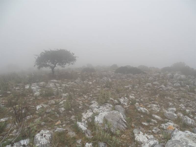
The asphalt is wet and gray clouds hang low over the mountains. It looks like it's going to rain, but for now it's dry. My left knee is still a bit sore after yesterday's fall, but luckily it doesn't really hurt. I leave my apartment on the outskirts of Sokraki and descend on a wide gravel road that turns into a nice narrow forest path with green ferns and fields of dry gray grass. Eventually I get to the asphalt road that leads to Spartillas. No olive groves here, but vineyards with high green mountains in the background, the peaks hidden in cloud cover. Which of these mountains is Pantokrator, I wonder. I get to traverse one of those mountains and it looks like a decent climb awaits me. But first I enter the village, where I catch a glimpse of the sea between the houses. The sun casts bright spots on the water, it is a work of art. I deviate from the trail for a while to do some shopping in a mini supermarket. The mini supermarket in Sokraki was so mini you could hardly call it a shop, more like a cafe with a few shelves of foodstuffs. After my backpack is a bit heavier and some cans of cola and other tasty things, I start the climb out of the village. Through picturesque alleys with inhabited houses and closed ruins side by side I follow the yellow markings, which are again accompanied by the green-white stripes of the Corfu Mountain Trail.On a concrete road high above the village I meet two Englishmen, who have explored the route to the top and will go up tomorrow. The young man says that there is a tough part of a kilometer ahead, but that it gets easier after that. In reality it’s not that bad. Yes, it's steep and sweat drips from my forehead, but it's not complicated. There’s calm zigzagging, occasionally some rocks. My hands sweat so much that even with cork handles I can barely grip my trekking poles. With the straps around my wrists I pull myself up the mountain side meter by meter. Then it flattens out and I come across flowering heather. At the ruins of an old house I have an unobstructed view over the bay. In the distance I see Corfu Town, with its straight runway and a cruise ship in the harbor. According to the GPS I'm not quite at the highest point yet, but from here the path continues fairly flat. It meanders over forest paths and through low grass and every now and then I come across cow pies. Unnoticed I rise higher, or have the clouds come down? The gray closes in on me until I can only see a hundred meters ahead. The character of the mountain also changes, I exchange the forest for a landscape of rock and bare trees, mountain in its rawest form. It is exuberantly marked and that is necessary, because countless paths each choose their own direction. Every now and then I check the GPS dor confirmation, but I'm always on the right track. It takes a good long while, up there on the mountain and I'm hungry to go down to the beach at the end. Finally I climb over a last rocky outcrop to an asphalt road. I only have to follow it for a short while before I turn into a gravel road. Some hikers, well dressed in rain gear, meet me. And there I am: in T-shirt and shorts. Luckily I'm not cold.The gravel road runs along the edge of a deep valley of reds and browns and hills that flow into each other like quiet waves. In the depths I see two hikers on a narrow path and for a moment I'm jealous, isn't that much more fun than a gravel road? But that gravel road is actually an easy hike and when I encounter a yellow paint stripe again, I am reassured. At a covered picnic area the arrow points steeply down and I can take my own narrow trail, down to the valley. Again it is not a difficult or hard path and I enjoy the view. Slowly I come under the clouds and the landscape becomes focused and clear again. A village of gray houses stretches out below me, Old Perithia, the oldest village in Corfu whose history goes back to the 14th century. It's quite a tourist attraction and I share the streets with couples in slippers and a single pram. Honey is sold and handicrafts made from olive wood. At the edge of the village, the parking lot is full of cars, but before that I turn to a gravel road and have the trail all to myself again. The gravel road turns into a forest path and I consider myself lucky that the north is so much rougher than southern Corfu. Here no gravel roads along olive trees, but real hiking trails where the bushes grab at your calves and with soft earth under my feet. That's the way it should be. Just past Krinias I meet two English ladies, Mary and Jo, who are doing some day walks. We chat pleasantly about hiking trips and walk together, until I decide in the run-up to Almiros Beach that their strolling pace is really too slow for me. My feet, still sensitive after yesterday's long day, are aching and longing for a break. At a diner I stop for a coke and a cake and a little later Mary and Jo join me. From here they take a taxi back to their car, I walk a little further along the beach and low dunes. The route deviates slightly from the GPS, but takes me on a gravel road to Agios Spiridonas, the place where the Corfu Trail ends without fanfare.My choice for the Corfu Trail was based on convenience, but looking back I am pleasantly surprised how beautiful it was, the landscape, the views over the sea. What a fantastic experience again.
Watch my YouTube videos of this hike here.